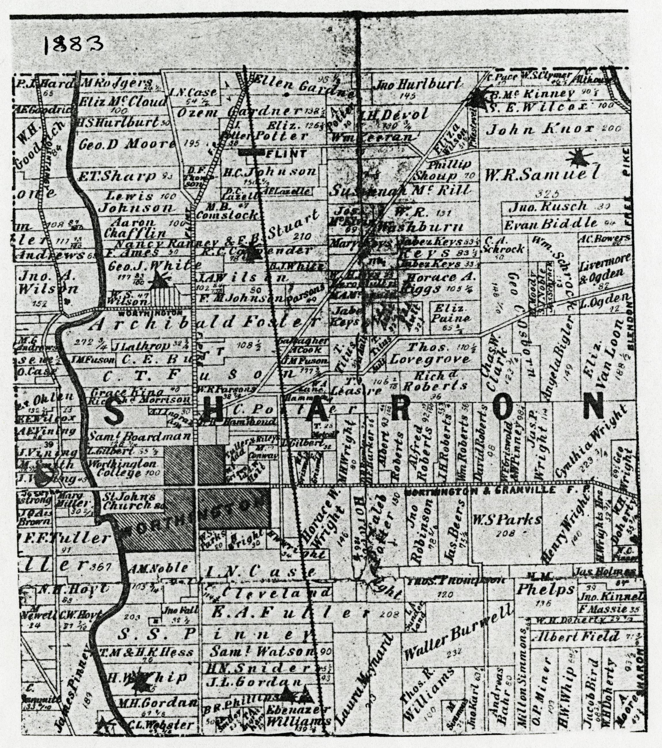
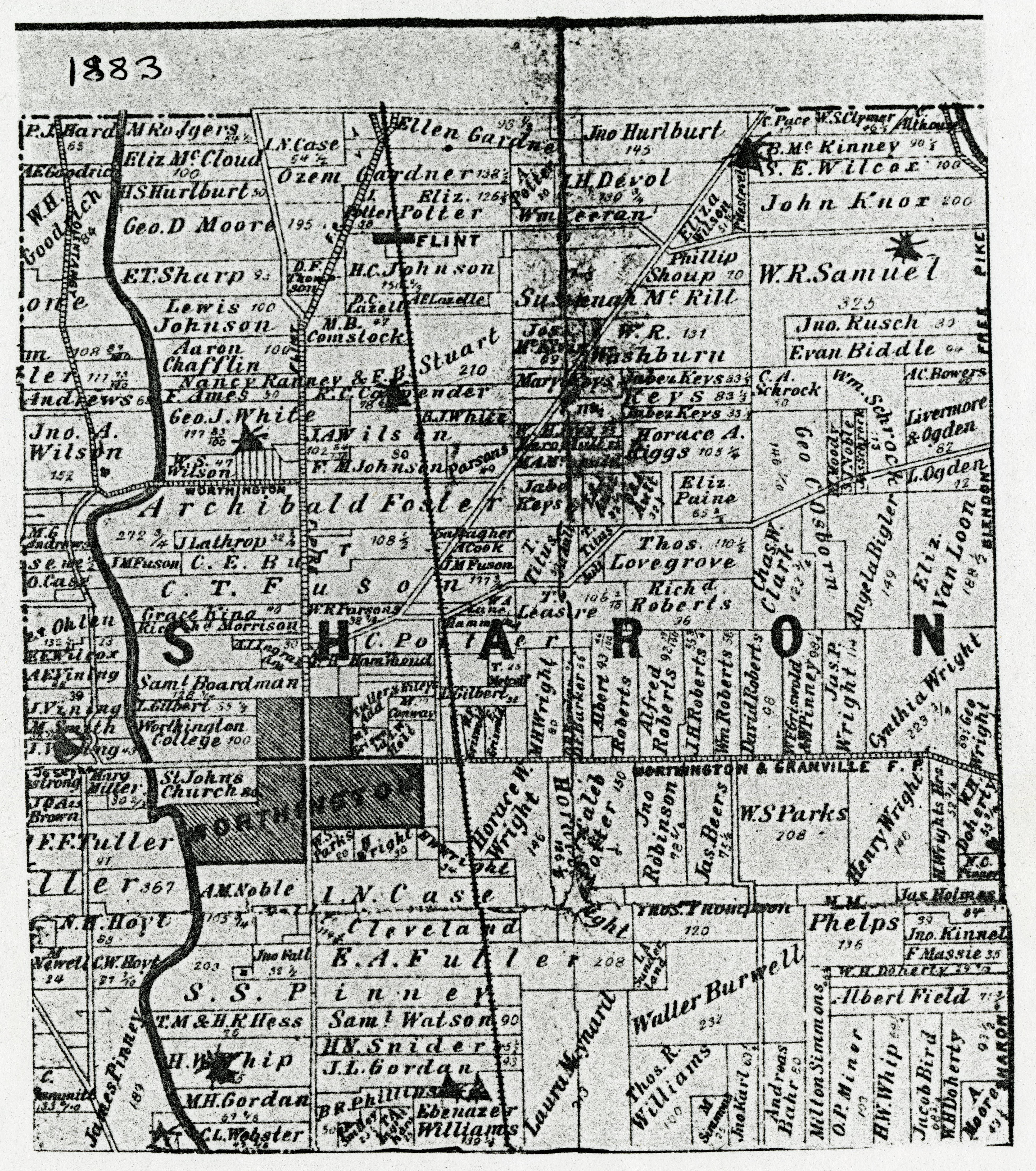
1883 Map of Sharon Township, Franklin County, Ohio

Basic details
Its dimensions are 7 in. x 6 in..
It was created sometime in 1883.
Columbus Metropolitan Library is the contributor.
G. J. Brand & Company is the publisher.
You can find the original at Columbus Metropolitan Library.
Background
This plat map shows property ownership within Sharon Township, Franklin County, Ohio, in 1883. It's taken from "The Map of Franklin County, 1883," which was donated to the Columbus Library by The Franklin County Genealogical and Historical Society.
Record details
This file was reformatted digital in the format video/jpeg.
The Worthington Memory identification code is cml0003.
This metadata record was human prepared by Worthington Libraries on . It was last updated .


