1910 Property Map of Sharon Township, Franklin County, Ohio
Description
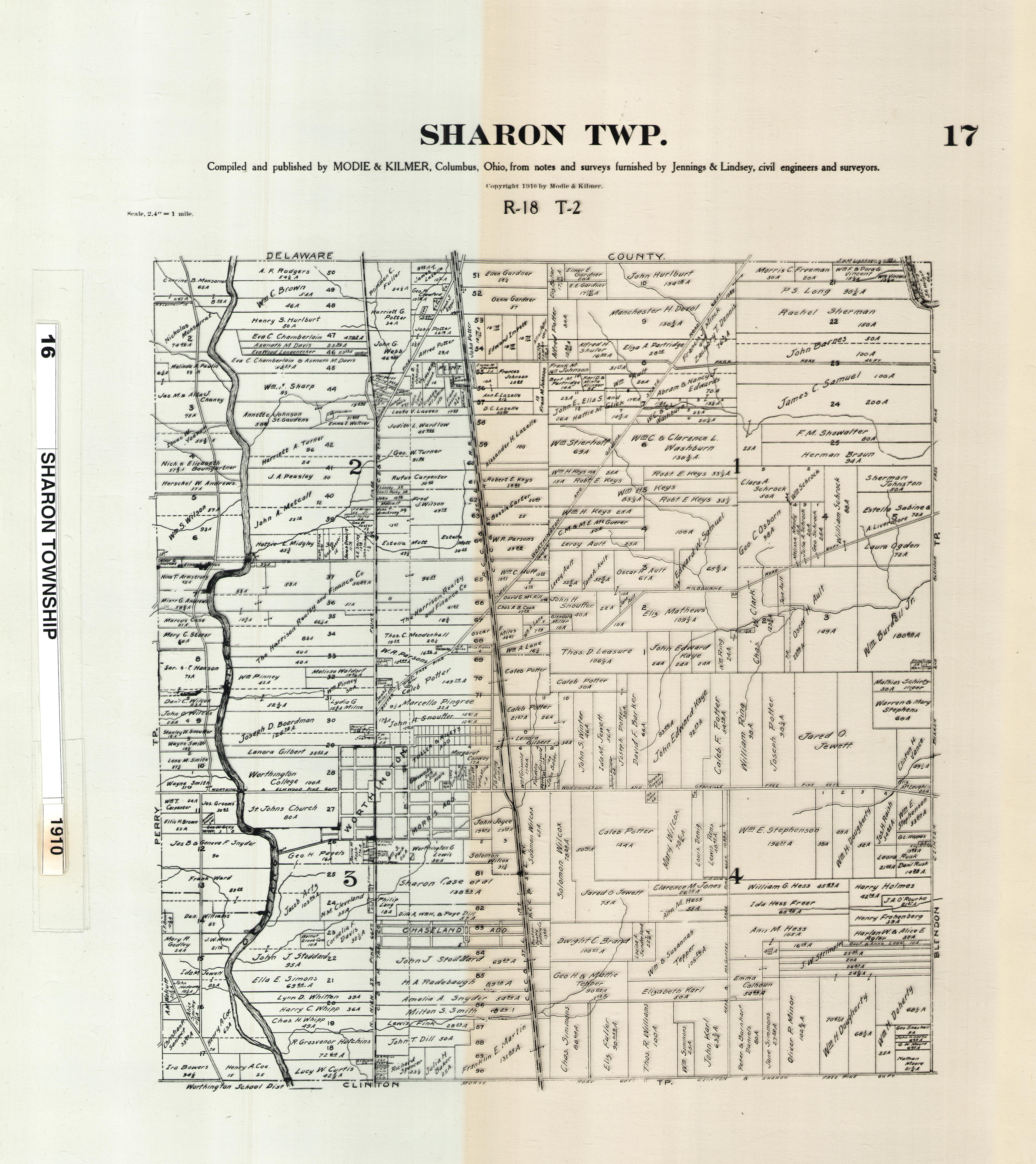
This plat map shows property ownership within Sharon Township, Franklin County, Ohio in 1910, taken from a series of township maps owned by the Franklin County Engineer.
Basic details
It was created sometime in 1910.
Franklin County Engineer is the contributor.
You can find the original at Franklin County Engineer.
Record details
This file was reformatted digital in the format video/jpeg.
The Worthington Memory identification code is fce0001.
This metadata record was human prepared by Worthington Libraries on . It was last updated .