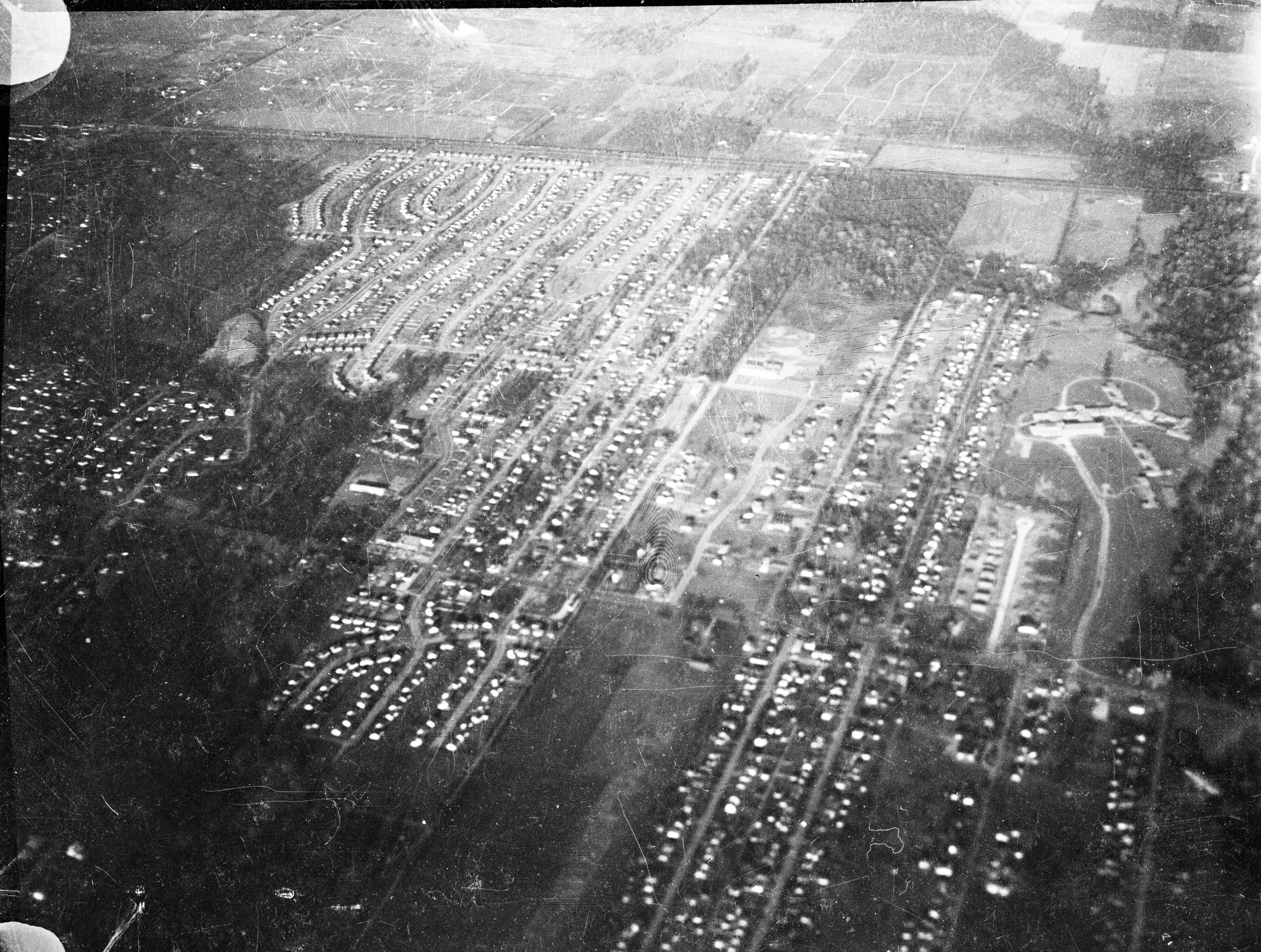
Aerial Photo of Colonial Hills and Ohio School for the Blind
Description
This black-and-white, aerial photo shows a view of Worthington sometime in the 1950s decade. The photograph is oriented with east at the top and north to the left. At the far left, lower corner of the photo, Walnut Grove Cemetery appears as a dark area, with the distinctive shape of West Lincoln Avenue and Sharon Springs Drive criss-crossing visible just above it. High Street intersects the photo from left to right above that, with the Colonial Hills neighborhood shown in the center far-left of the photo. West Kanawha and Rosslyn avenues run from the bottom center of the photo to the middle-right. The Ohio State School for the Blind is located at the far right center of the photo. Sinclair Road runs from left to right in the top quarter of the photo. Above that is a patchwork of fields and homes to the east. Homes appear as tiny white and darker dots. The photograph is darkest nearest the bottom and fades as the landscape retreats into the distance at the top.
The photograph was taken by A.V. Shirk when he was a child, riding in his father's airplane. He writes:
"In the 1950s, my father, Al Shirk, owned a small airplane, a two-person Ercoupe...in which he would take my mother, my brother, my sister or me flying all over central Ohio. On some of these occasions, I took my Speed Graphic press camera and took pictures. When I wanted to take a photo, I would pull down the window of the cockpit, and Dad would then turn and bank, to give me a good view. I suppose holding a large camera, with a leather bellows, that close to the slipstream would strike some people as chancy, but nothing untoward ever happened. We lived, at that time, at 525 Meadoway Park, in Colonial Hills."