1872 Property Map of Worthington, Ohio
Description
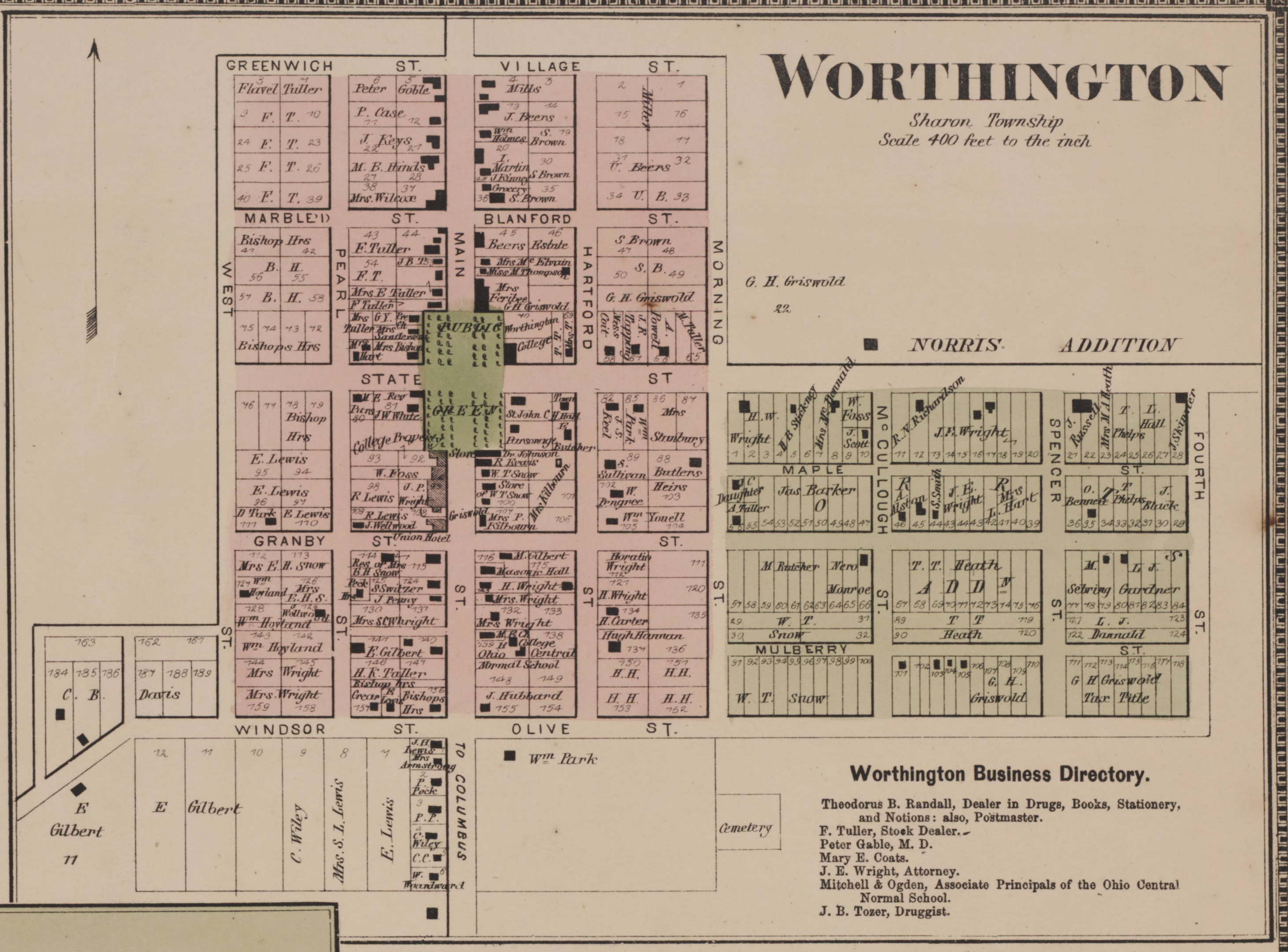
This color map of property ownership in Worthington, Ohio is taken from the "1872 Caldwell's Atlas of Franklin Co. and of the City of Columbus, Ohio: from actual surveys," contributed to the Columbus Metropolitan Library by Hueston T. Gould. It shows property ownership in Old Worthington and the Morris Addition, and has a brief business directory.
Street names that have changed are: State Street became Dublin-Granville Road, Main Street became High Street, Greenwich Street/Village Street became North Street, Marble Street/Blanford Street became Stafford Avenue, Granby Street/Berlin Street became New England Avenue, Windsor Street/Olive Street became South Street, Union Street/Pearl Street became Oxford Street and Vernon Street became Hartford Street.