1874 Plat of Old Worthington
Description
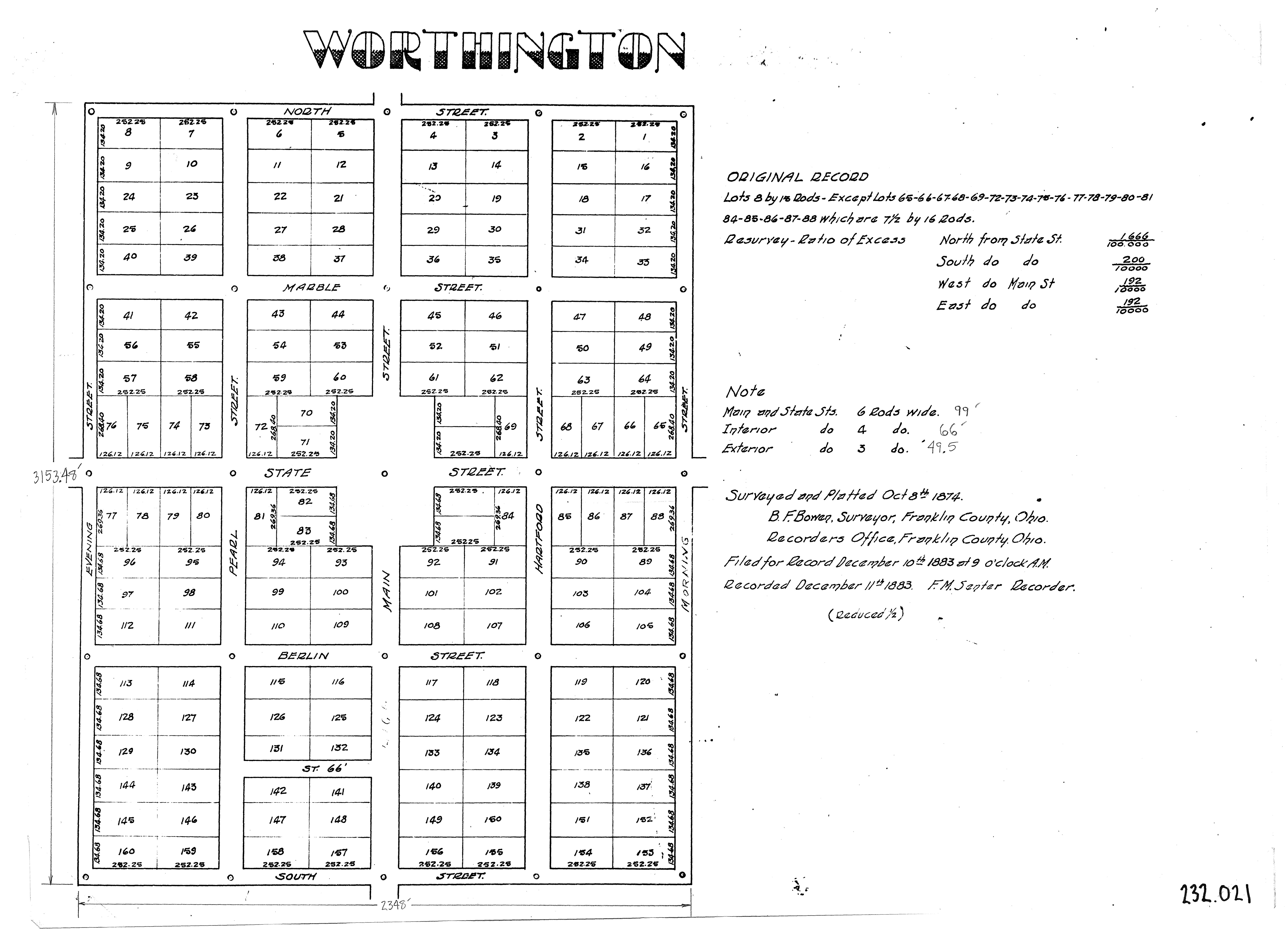
This black-and-white reproduction of a plat map from 1874 shows lot numbers of Old Worthington, as assigned by the original 1803 plat of Worthington.
The map shows earlier street names for Old Worthington: the modern-day High Street was known as "Main Street," Dublin-Granville Road was "State Street," Stafford Avenue was "Marble Street," New England Avenue was "Berlin Street" and Oxford Street was "Pearl Street."
Basic details
It was created October 8, 1874.
City of Worthington is the contributor.
B. F. Bowen is the creator.
You can find the original at City of Worthington.
Subjects
It covers the topics maps and street names.
It covers the Worthington neighborhood
Old Worthington.
Record details
This file was reformatted digital in the format video/jpeg.
The Worthington Memory identification code is cow0147.
This metadata record was human prepared by Worthington Libraries on . It was last updated .