Aerial Photo of Old Worthington and Surrounding Neighborhoods
Description
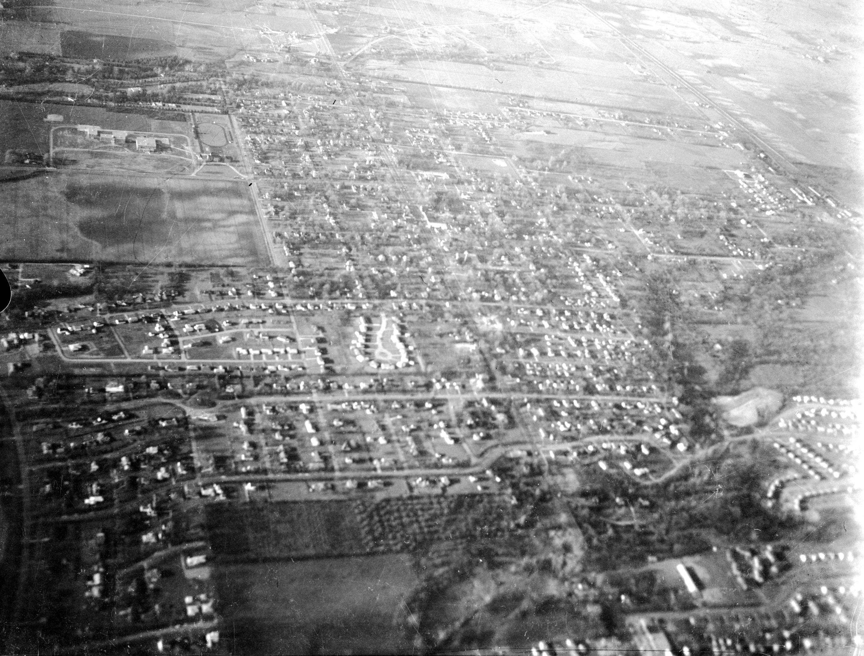
This black-and-white, aerial photo shows a view of Worthington sometime in the 1950s decade. The photograph is oriented with north at the top. In the center at the top third of the photo is Old Worthington with the Village Green at the center. To the left (west) is the Worthington High School campus (now Thomas Worthington High School). Below that is Dublin-Granville Road, which intersects the photo from left to right. Below the high school campus is the undeveloped area that would become Kilbourne Village in the late 1950s; it appears as a gray, featureless area. From left to right (west to east) are the Village of Riverlea (lower left-hand corner); the Oxford Court neighborhood (with a cul-de-sac in a distinctive circular shape); Park Highlands and Rush Creek Village. High Street intersects the photo on a diagonal from top to bottom of the photo. The area south of Southington Avenue, around the Rush Run tributary, appears to be farm fields or an orchard. Homes throughout the photo appear as tiny white and darker dots. The photograph is darkest in the lower left and fades as the landscape retreats into the distance at the top.
The photograph was taken by A.V. Shirk when he was a child, riding in his father's airplane. He writes:
"In the 1950s, my father, Al Shirk, owned a small airplane, a two-person Ercoupe...in which he would take my mother, my brother, my sister or me flying all over central Ohio. On some of these occasions, I took my Speed Graphic press camera and took pictures. When I wanted to take a photo, I would pull down the window of the cockpit, and Dad would then turn and bank, to give me a good view. I suppose holding a large camera, with a leather bellows, that close to the slipstream would strike some people as chancy, but nothing untoward ever happened. We lived, at that time, at 525 Meadoway Park, in Colonial Hills."