
Downloads
Full view (jpeg: 126.27 KB)
Learn more about copyright and access restrictions for use of materials from Worthington Memory.
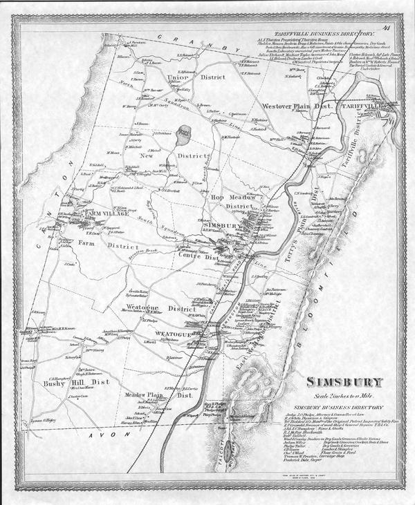
Map of Simsbury, Connecticut is cartographic material, with genre map. Its dimensions are 17 in. x 14 in..
It was created in 1869.
Baker & Tilden is the Creator. Worthington Libraries is the Contributor.
Reprint of 1869 Map of the Districts of Simsbury, Connecticut. Many early pioneers of Worthington came from this region. The names and businesses shown on the map are often the same as those found in Worthington. Family ties remained strong for several generations, as nephews, nieces, and cousins would visit each other.
You can find the original at Worthington Libraries.
This file was reformatted digital in the format video/jpeg.
The Worthington Memory identification code is wpl0021_001.
This metadata record was human prepared by Worthington Libraries on October 7, 2002. It was last updated July 3, 2025.