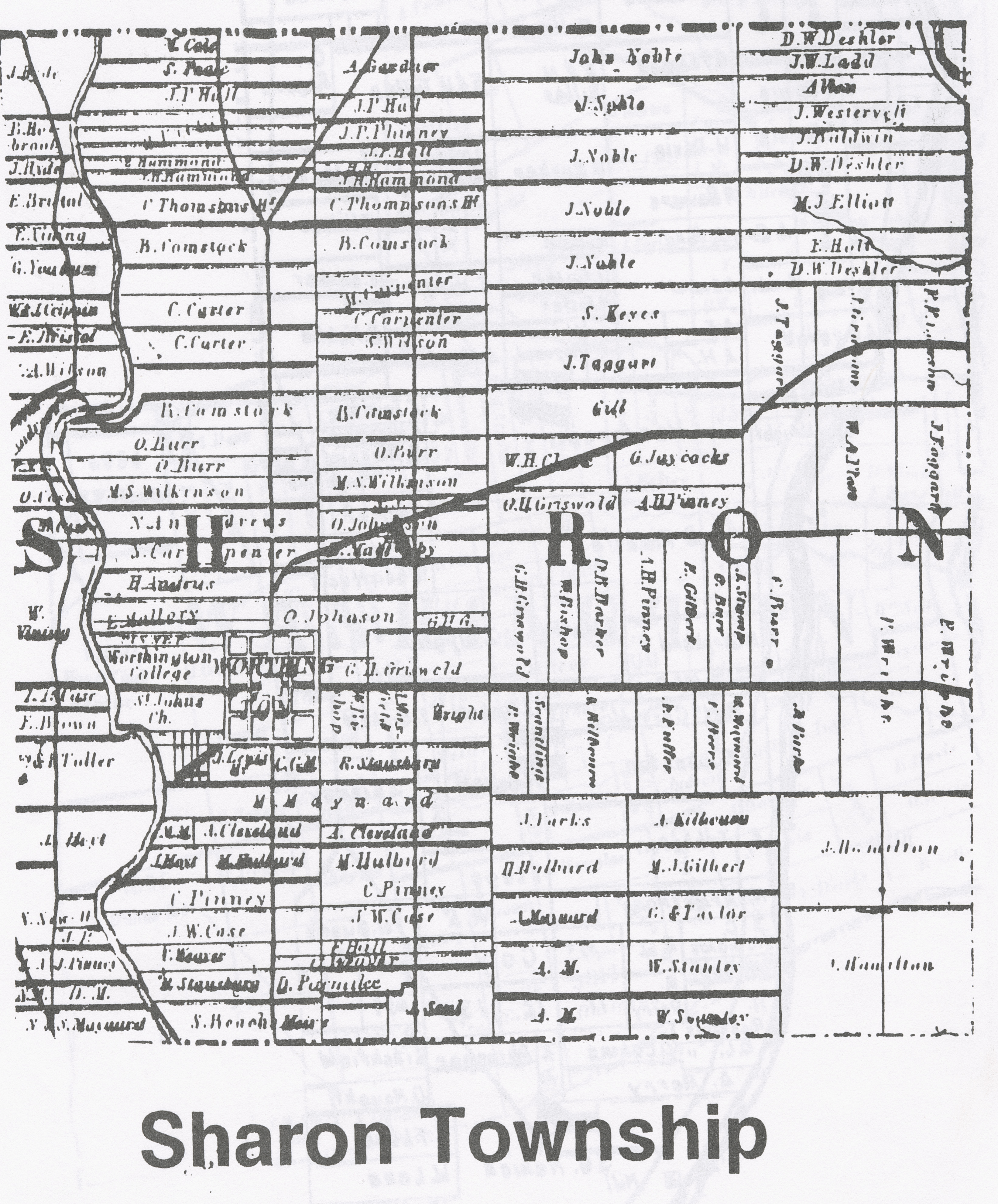
1842 Property Map of Sharon Township, Franklin County, Ohio
Description
This map shows property ownership in 1842 for Sharon Township in Franklin County, Ohio. It's taken from page four of the book "Franklin County, Ohio 1872 Historical Atlas and Plat Maps 1842, 1856, 1883 Indexed," published by the Franklin County Genealogical Society in 1998. The 1842 map was originally engraved and published by E. F. Wheeler in Columbus, Ohio.
Basic details
Its dimensions are 6.61 in. x 5.47 in.
It was created sometime in 1842.
Worthington Libraries is the contributor.
Franklin County Genealogical and Historical Society is the publisher.
E. F. Wheeler is the creator.
You can find the original at Old Worthington Library.
Record details
This file was reformatted digital in the format video/jpeg.
The Worthington Memory identification code is wpl0611.
This metadata record was human prepared by Worthington Libraries on . It was last updated .