
Downloads
Full view (jpeg: 80.08 KB)
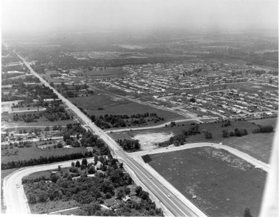
Aerial View of High Street (Rt. 23) from the collections of the Worthington Historical Society (WHS) may be used for educational purposes as long as it is not altered in any way and proper credit is given: "Courtesy of the Worthington Historical Society, Worthington, OH." Prior written permission of the WHS is required for any other use of Aerial View of High Street (Rt. 23). Contact WHS at info@worthingtonhistory.org to request permission.
Learn more about copyright and access restrictions for use of materials from Worthington Memory.
Aerial View of High Street (Rt. 23) is a picture, with genre photograph. Its dimensions are 7 in. x 9 in..
It was created in 1974.
Worthington Historical Society is the Contributor.
Aerial view of High Street (Rt. 23) looking southwest.
The rural character of Worthington and Sharon Township changed rapidly in the post-war period. Single family houses in suburban areas were very desirable. Worthngton had a good school system, easy access to the downtown, and an attractive appearance. Earlier developments were Colonial Hills in the 1940's and Kilbourne Village in the 1950's. The Worthington Estates development is depicted in the upper right corner of this photograph.
It covers the topics streets and roads, streets and roads and urbanization.
It covers the city Worthington.
You can find the original at Worthington Historical Society.
This file was reformatted digital in the format video/jpeg.
The Worthington Historical Society identification code is 99-G-81. The Worthington Memory identification code is whs0049.
This metadata record was human prepared by Worthington Libraries on December 12, 2001. It was last updated November 17, 2017.