Wednesday,
February 6, 2019
1:49pm
The absence of foliage and clarity of the air in wintertime may extend your line of sight-- and you can see even further in this collection of aerial photographs taken high above Worthington. These images span decades, representing the landscape across the 1950s, '60s, '70s and '90s. Check out the "More Nearby…" link alongside each photo for the geographic coordinates and current satellite image of each location and you'll see just how much some areas of town have developed, while others appear virtually unchanged.
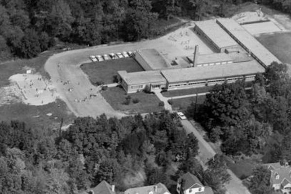
A major development in Worthington's history is connected to the oldest photograph in this collection, taken in the mid-to-late 1950s over Colonial Hills Elementary School. The Colonial Hills subdivision was annexed to the eastern portion of Worthington in 1954, and it quickly became evident a new school would be needed to accommodate the influx of students (not to mention the baby boom that was projected to continue for years to come). Construction was completed in time for the start of the 1955 school year. Depicted just north of Colonial Hills, in an aerial photograph taken in 1971, is the former campus of Harding Hospital, a mental health research and treatment facility which had relocated to east Worthington roughly 50 years earlier and which would eventually return to Columbus (in 1995) as part of a merger with the Ohio State University Medical Center. The Step-by-Step Academy for behavioral health purchased the campus in 2013 and continues to utilize the space. The director of Harding Hospital, Dr. George T. Harding III, also provided foundational funding and leadership for Worthington Foods, which began operation in 1939 (as Special Foods) directly across Dublin-Granville Road from the Harding Hospital campus. Worthington Foods would expand its facilities and operations during the ensuing decades before being purchased by the Kellogg's food manufacturing company in 1999. Following acquisition and brief utilization by Jubilee Foods, the facilities would cease operation in 2006 and have since been razed (though they were still visible in the same 1971 aerial photo).
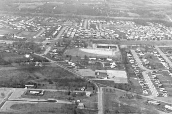
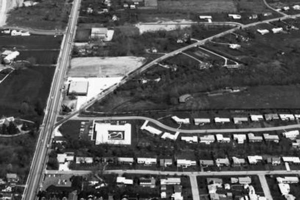
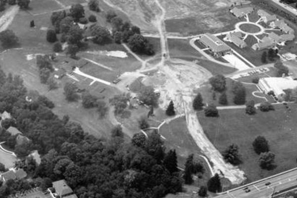
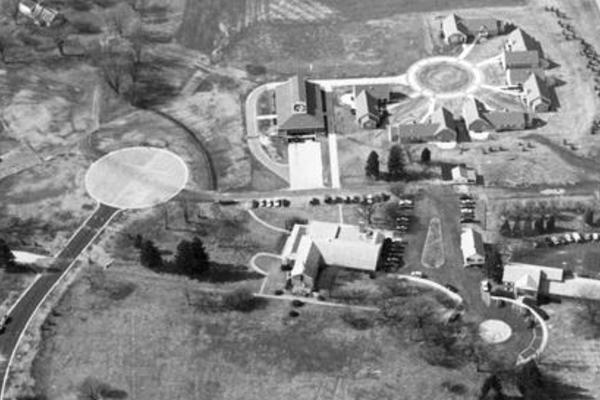
To the northwest, another 1971 aerial photograph depicts the area around Worthington Galena and Schrock roads and looks west toward High Street, which cuts across the middle of the frame. Absent in this image are Worthington Christian Schools (which would open a few years later), the Kensington Place neighborhood and the additional trees and homes that would accompany the eventual expansion of the surrounding residential areas. (The Worthington Acres neighborhood is almost completely empty in this image, and though Worthington Estates East is visible to the northeast of Worthington Galena Road, it hadn't yet crossed into the point of land bordering Schrock.) An aerial photo from 1960 floats our view slightly further west along Worthington Galena Road to its intersection with High Street and features a smaller version of the United Methodist Children's Home (UMCH), which would celebrate its 50th anniversary the following year. Additional photos from the early '90s offer a time-lapsed, birds-eye view of UMCH's construction of additional facilities, a project that would bring the campus close to its current appearance.
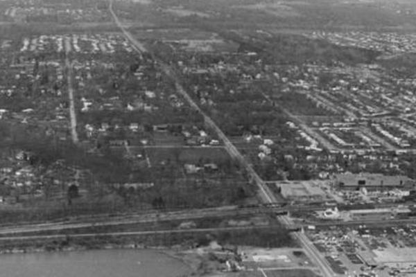
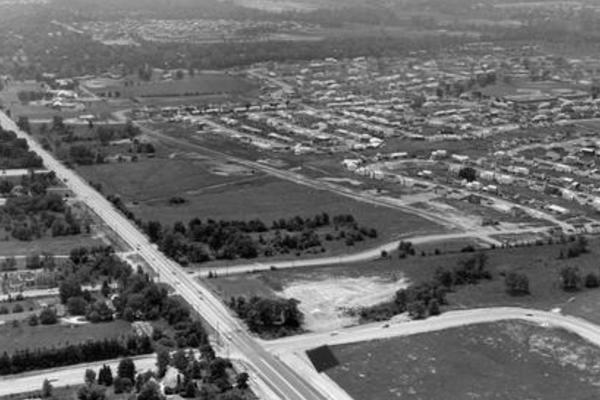
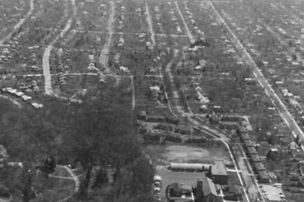
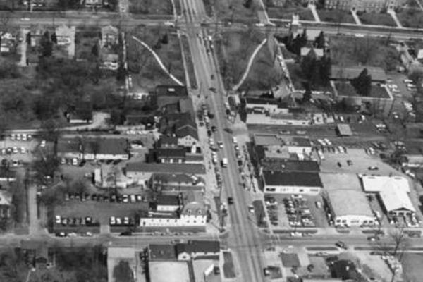
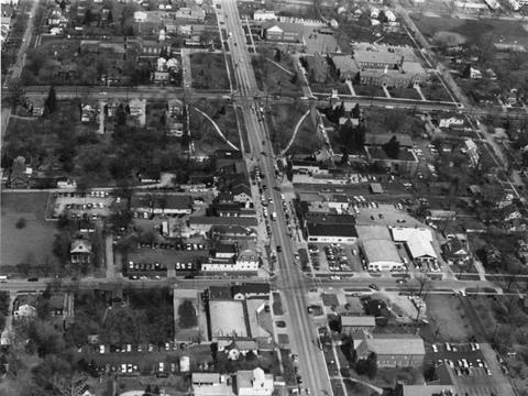
A short flight up North High Street brings us to the location of a (1974) view of the intersection of North High and Wilson Bridge Road, looking southeast down North High. Like the opposite-angled photograph from 1960, this one shows the area surrounding the intersection as mostly undeveloped land-- a striking contrast to its currently commercially-bustling state, which kicked off with the opening of the Worthington Square Shopping Center in 1972. (Although the shopping center was open when the 1974 aerial photo was taken, it was positioned slightly behind the photographer.) Directly in front of the photographer at North High Street and Wilson Bridge Road (and stretching across the top third of the image), are the woods running out of Old Worthington, behind Thomas Worthington High School (TWHS) and on through the Medick Estates neighborhood-- with a portion of Antrim Lake visible just beyond.
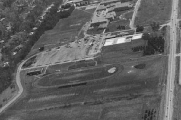
For a closer, "widescreen" look at this western portion of Worthington, check out the duo of 1971 aerial photos taken above the Olentangy River and facing east onto Medick Estates and the TWHS campus. If you click the image of Medick Estates and zoom in toward the upper-left (and squint a bit, too), you can see the comparatively young UMCH campus-- and the juncture of North High and Worthington Galena-- just east of Medick Estates. The neighborhood, and TWHS campus alongside it, look similar to their current appearances apart from the absence of the indoor facilities at Worthington Pools. Construction of a natatorium next to the existing outdoor pools (visible in the 1971 photos, just beside the TWHS parking lot) began in 1972 after a successful fundraising drive for the project. Following Dublin-Granville Road/Highway 161 east, up the right portion of the frame, takes us through Old Worthington to the school building now known as Kilbourne Middle School.
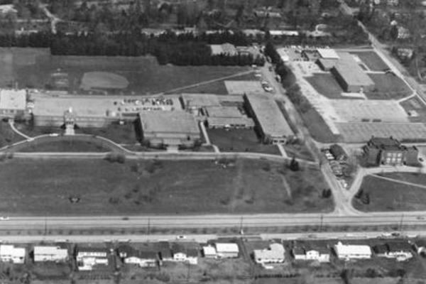
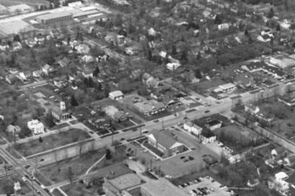
A separate photo taken from the opposite angle offers a closer view of the middle school, which at that time (1971) lacked the expanded gymnasium that presently features on the building's east side. The school would go on to serve as a 9th-grade-only building before closing in 1991 (due to the opening of Worthington Kilbourne High School on Hard Road) and reopening as a middle school two years later. In the same photo, the current site of Old Worthington Library is occupied by residential buildings and the Old Rectory, which at that time housed the Worthington Schools' administrative offices. The library was still years away from relocating into the new building that would be constructed there; groundbreaking took place in 1978, after a deal for the land had been reached between the school system and the library. The Worthington Historical Society purchased and relocated the Old Rectory to its current location at 50 W. New England Avenue.
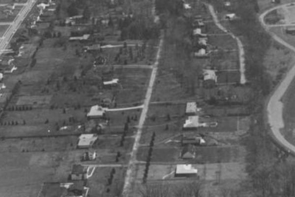
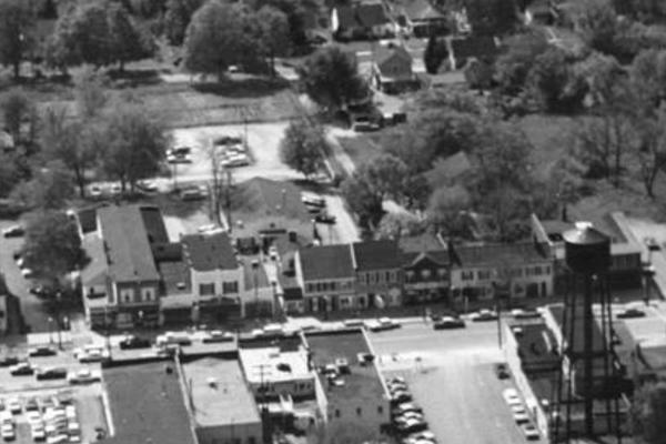
This collection also offers a glimpse of the Old Worthington business district in the late 1960s/early '70s. Although businesses have come and gone over the last several decades, new construction has rarely occurred; one visible exception in an aerial photo from this time is the old water tower that had occupied the business district for over 40 years. A new-and-improved water tower was constructed in west Worthington in the late '60s, and the old one was consequently razed before the taking of another aerial photo soon after. Additionally, you'll find empty space at the present-day location of the U.S. Bank branch (built in 1972 as the Worthington Savings Office of the Ohio State Bank) and a plainer facade at the site of Worthington Jewelers (renovations were undertaken in 2011 to create the red-roofed showroom visible in current satellite images). Farther south, we have a glimpse of a (then) relatively new St. Michael Catholic Church, photographed roughly two decades after its construction and lacking the additional facilities that would be created during renovations in the late '90s. In the same photograph, the Kenyon Brook neighborhood can be seen just north of the church, sporting even more trees (and fewer houses) than currently can be found there.
We hope this flyover of Worthington has expanded your historical field of view!