
Downloads
Full view (jpeg: 100.02 KB)
Learn more about copyright and access restrictions for use of materials from Worthington Memory.
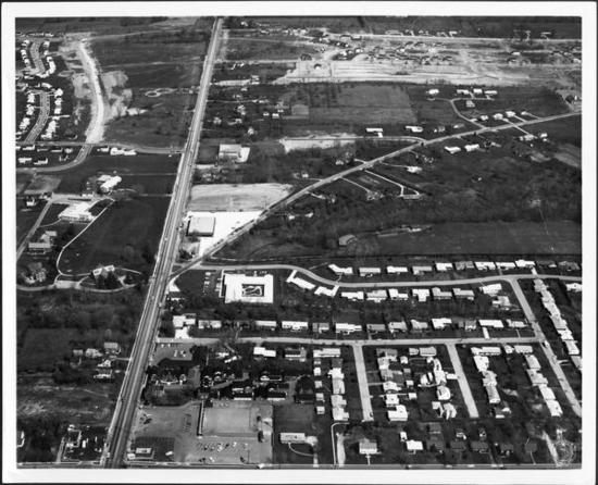
Aerial View of Worthington is a picture, with genre photograph. Its dimensions are 8 in. x 10 in..
It was created in 1970.
City of Worthington is the Creator.
This aerial view looks north up High Street. North Street can be seen at the lower portion of the photograph. Worthington Galena Road branches off to the upper right portion. New development along Wilson Bridge Road is visible at the top.
It covers the topics streets and roads and urbanization.
It covers the city Worthington.
You can find the original at City of Worthington.
This file was reformatted digital in the format video/jpeg.
The Worthington Memory identification code is cow0063.
This metadata record was human prepared by Worthington Libraries on August 25, 2003. It was last updated February 3, 2023.