
Downloads
Full view (jpeg: 80.45 KB)
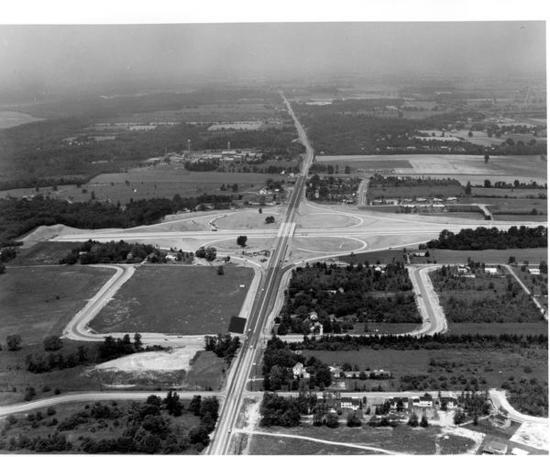
Aerial view of High Street (Rt. 23) and I-270 Interchange from the collections of the Worthington Historical Society (WHS) may be used for educational purposes as long as it is not altered in any way and proper credit is given: "Courtesy of the Worthington Historical Society, Worthington, OH." Prior written permission of the WHS is required for any other use of Aerial view of High Street (Rt. 23) and I-270 Interchange. Contact WHS at info@worthingtonhistory.org to request permission.
Learn more about copyright and access restrictions for use of materials from Worthington Memory.
Aerial view of High Street (Rt. 23) and I-270 Interchange is a picture, with genre photograph.
It was created in 1966.
Worthington Historical Society is the Contributor.
Aerial view of High Street (Rt. 23) and I-270 interchange, looking north. Pontifical College Josephinum is depicted in the upper left corner of this photograph.
Planning and construction of Interstate 270, the Columbus Outerbelt, began in 1965. It was completed by the mid-1970's. Outerbelts were a common solution to traffic congestion due to urban sprawl. Businesses then moved to suburban locations, accelerating the decline of the inner city's economic life.
As development has spread beyond the outerbelt, fringe cities like Worthington have experienced economic challenges, as their geographic growth is limited.
It covers the topics U.S. Route 23, urbanization, streets and roads and Interstate 270.
It features the organization Pontifical College Josephinum.
It covers the city Worthington.
You can find the original at Worthington Historical Society.
This file was reformatted digital in the format video/jpeg.
The Worthington Historical Society identification code is 99-G-80. The Worthington Memory identification code is whs0051.
This metadata record was human prepared by Worthington Libraries on December 12, 2001. It was last updated March 30, 2023.